Utilization and Application in Road Administration
Example 1. Vehicle Information and Communication System (VICS)
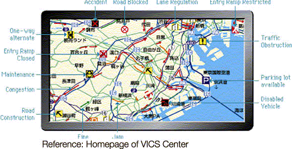
In VICS, signals from radio beacons, optical beacons, and FM multiplex broadcasting are received by car navigation systems, and information on traffic congestion, regulations, accidents, parking facility vacancies, etc. is displayed in real time on the screen of a car navigation system in the form of text, simple diagrams, or maps. The DRM Database is stored in the car navigation system, and this is used to display information on congestion, etc. at the road location on the screen.
Example 2. Special Vehicle Transit Permit Application System
To operate a special (overweight/oversize) vehicle, a permit must be obtained by filing an application with the office of the national or regional government or other entity which manages the roads of the planned route. The DRM Database is used in the online applications system for special vehicle transit permits, contributing to easy transit route selection.
Example 3. Integrated Traffic Accident Database
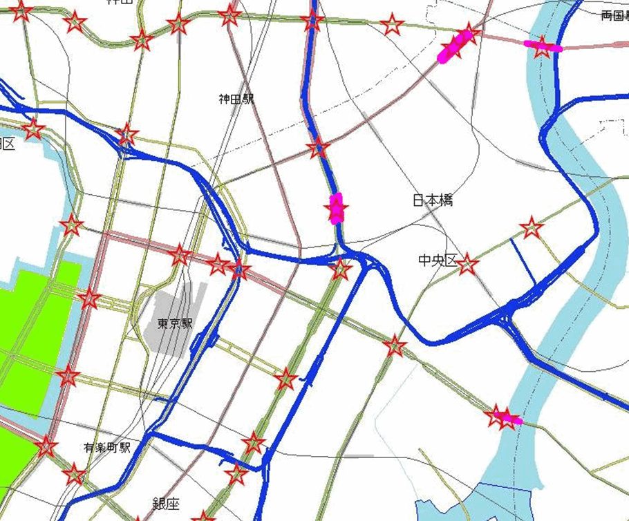
Traffic accident data is integrated and analyzed comprehensively by Institute for Traffic Accident Research and Data Analysis(ITARDA). ITARDA records the positions of traffic accidents using the link data of the DRM database.The Japanese government, local governments and private companies utilize the ITARDA database to prevent traffic accidents.
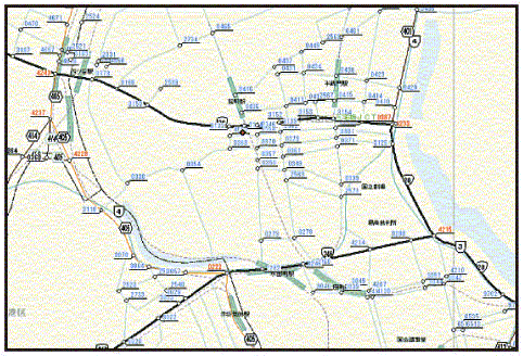
Example 4. Road Traffic Census Analysis
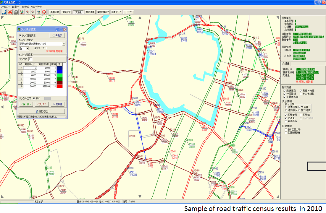
The road traffic census is generally performed every five years in the whole conutry. The DRM Database is used for compilation of the survey results, such as computerized preparation of traffic volume maps, and various analyses of congestion and so on.
Examples of other uses (by road administrators and national and regional governments)
- National Integrated Transport Analysis System (NITAS)
- Database of programs for traffic congestion control
- Study of access to suitable candidate sites for parks, etc.
- Flight path information display system
- Road maintenance and management system
- Traffic sign evaluation and management system
- Visual 3D mapping of road traffic conditions
- Study on improving spaces for bicycle transit
- Jurisdictional general purpose maps and pamphlets
Utilization and Application in Regional Disaster Prevention and GIS
Example 5. Evacuation Assistance In Case of Tsunami Warning (In development)
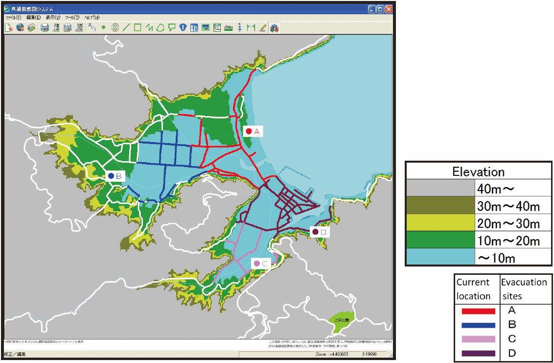
When a tsunami warning is issued, the car navigation system will be able to navigate the vehicle to safer areas arriving in the shortest time if the elevation data of all the roads in the vicinity of the currently driving road are available. The map is experimentally drawn with especially road elevation data as well as other data of the DRM Database, showing names and locations of evacuation sites located in higher altitudes than the current location.
Example 6. Information Delivery System In Case of Disasters
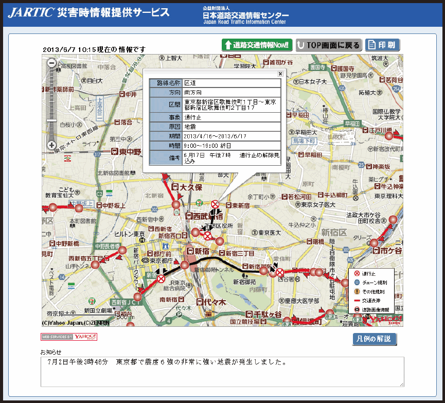
In case of earthquakes or natural disasters where road systems are affected, Japan Road Traffic Information Center(JARTIC) has started an information delivery system in 2013 that announces information on roadblocks and traffic congestion. The DRM database is used for location display in this system.
Examples of other uses related to disaster prevention
- Disaster and road management map information system
- Integrated disaster prevention systems
- Basic data for indices to evaluate the effectiveness of earthquake disaster prevention investment
- Road earthquake information sharing system
- Maps of bridge earthquake resistance strength
Utilization and Application in Car Navigation and Others
Example 7. Car navigation systems
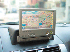
These systems accurately match measurements from various sensors and GPS satellites to digital road maps in order to display the current location and indicate the optimal route to the destination. This accurate map information is based on the DRM Database which expresses up-to-date road conditions and road network.
Example 8. Support and planning system for new store openings
There has been a rapid increase in the number of companies which use GIS for market surveys and planning new store openings. These geographic information systems also make use of the DRM Database.
Example 9. Publishing electronic maps
The DRM Database is also used for publishing electronic maps which are provided on the Internet or on DVD, CD-ROM, etc. Along with the astounding spread and advancement of the personal computer, electronic maps are becoming more widespread and increasingly diverse, creating new value.
Examples of other private uses
- Car location systems
- Systems to assist safe driving
- Operation management and logistics management systems